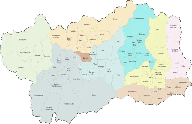
Map of the Unités des Communes

The municipalities of the Aosta Valley, except Aosta, are grouped into eight Unités des Communes (unions of municipalities). Their full official name is “Unités des Communes valdôtaines”: Valdigne-Mont-Blanc, Grand-Paradis, Grand-Combin, Mont-Émilius, Mont-Cervin, Évançon, Mont-Rose and Walser. The map shows their boundaries.
Municipalities working together
Many municipalities in the Aosta Valley are small, often with only a few hundred inhabitants. On their own, they would struggle to provide some services. They therefore run them jointly, within an Unité des Communes. Each municipality belongs to a single Unité, which groups neighbouring municipalities sharing the same area.
A 2014 regional law creates the Unités
The Unités were created by regional law no. 6 of 5 August 2014. They replaced the former mountain communities (Comunità montane), which also numbered eight. Aosta, the only city in the region, is not part of one and runs its services alone.
What the Unités des Communes do
The Unités are responsible in particular for:
- the single desk for local authorities, which handles, for example, business-related procedures;
- some of the social services, such as help for older people;
- water and waste services;
- if the municipalities wish, the collection of certain local taxes.
Who runs the Unités: the mayors’ Giunta
Each Unité is run by an assembly, the Giunta, made up of the mayors of the member municipalities. It elects a president from among its members to represent the Unité. These posts are unpaid.
Maps: personal work by Marc Badjou.
Comments