The Ciarforon
The ice dome facing the Vittorio Emanuele hut
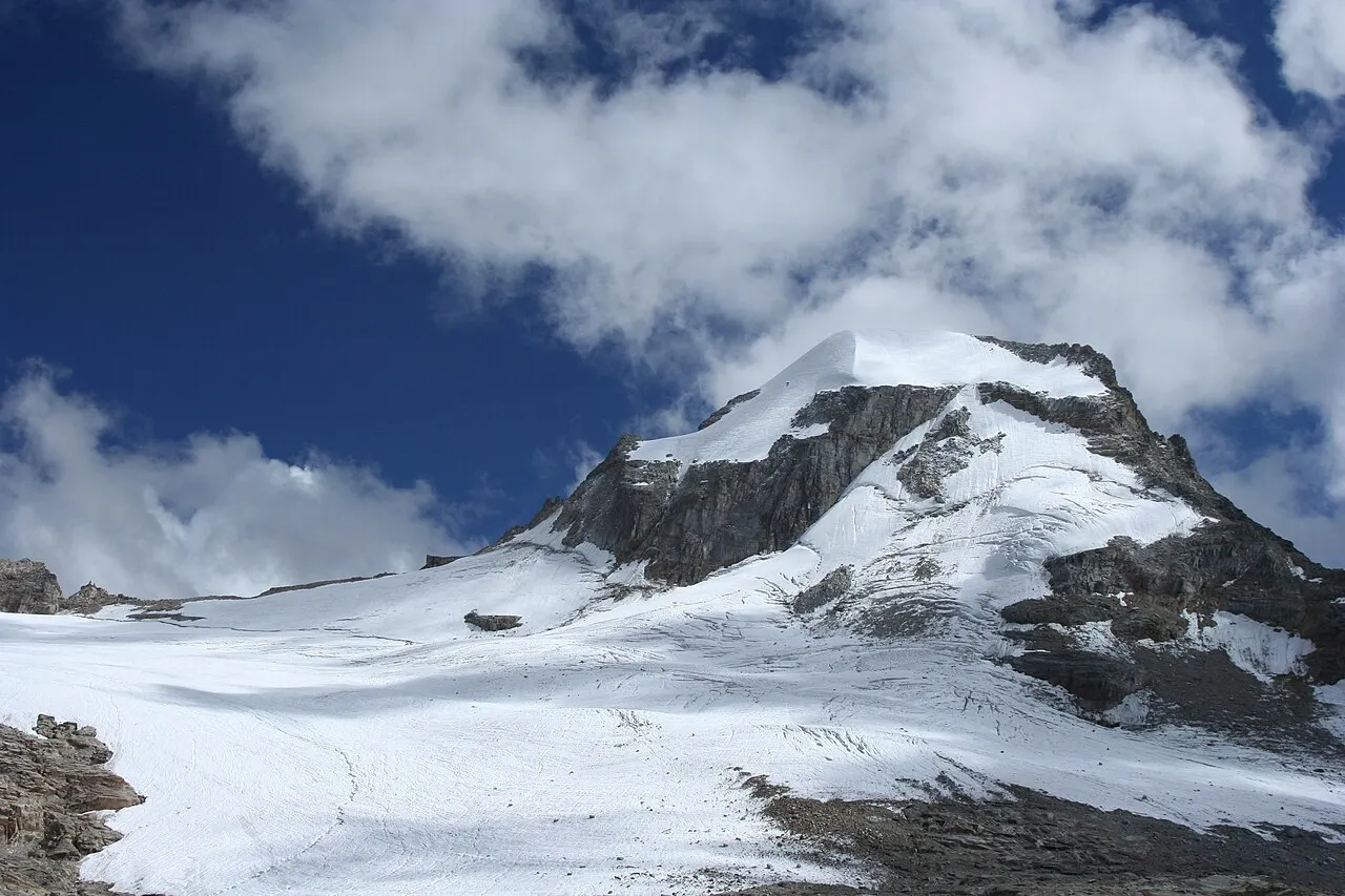
The Ciarforon reaches 3,642 metres at the head of the Valsavarenche, just south of Gran Paradiso. It stands on the watershed between the Aosta Valley and Piedmont: the Valsavarenche on one side, the Orco valley on the other. It is also spelt Charforon. It lies within the Gran Paradiso National Park.
An unforgettable shape
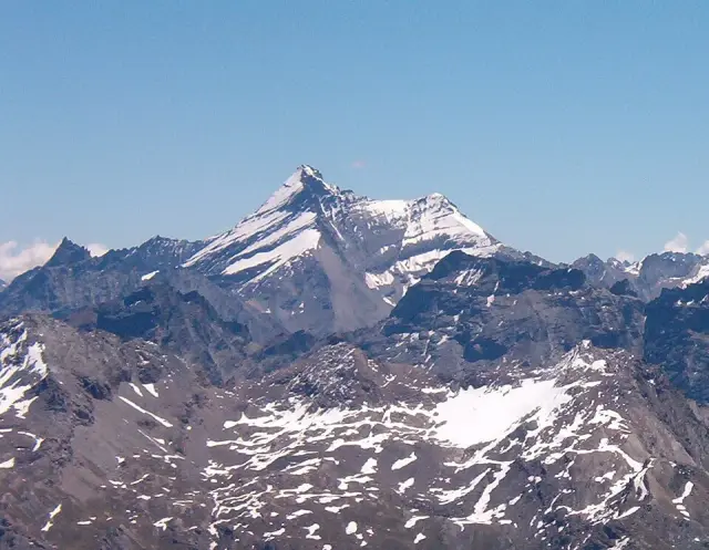
You recognise it at first glance. The summit is a great rounded dome, covered by a cap of ice, whereas its neighbours are rather pointed. It is glaciated on all four faces. To the south, on the Piedmont side, it shows instead a rock wall up to 300 metres high. The summit is so broad that a small cairn marks its highest point.
The north face, a wall of ice
Its north face, which looks towards the Vittorio Emanuele II hut, is an ice wall about 600 metres high. It is a classic route for ice climbers. Its conditions vary a great deal from year to year, and the retreat of the glaciers makes it trickier than it used to be.
The first ascent, in 1871
The first to reach the summit were F. Vallino and A. Blanchetti, on 25 August 1871, by the south-west ridge. Today the normal route starts from the Vittorio Emanuele II hut and joins the north-east ridge at the Col de Moncorvé, crossing a crevassed glacier.
Gran Paradiso’s neighbour
For many walkers, the Ciarforon is the mountain that comes into view on arriving at the Vittorio Emanuele II hut. Its white dome rises directly opposite, between the Tresenta and the Becca di Monciair. Gran Paradiso itself stays further back. From the summit of the Ciarforon you see the whole massif close up, and in the distance Mont Blanc and the Ruitor.
Getting there
Vittorio Emanuele II hut (2,732 m)
Località Moncorvé
11010 Valsavarenche (AO)
+39 0165 95920 · rifugiovittorioemanuele.com
The best place to see it is the Vittorio Emanuele II hut, two and a half hours’ walk from Pont, at the head of the Valsavarenche, on a good path. The summit is a glacier climb, with crevasses and steep slopes: it is done roped up, with a mountain guide.
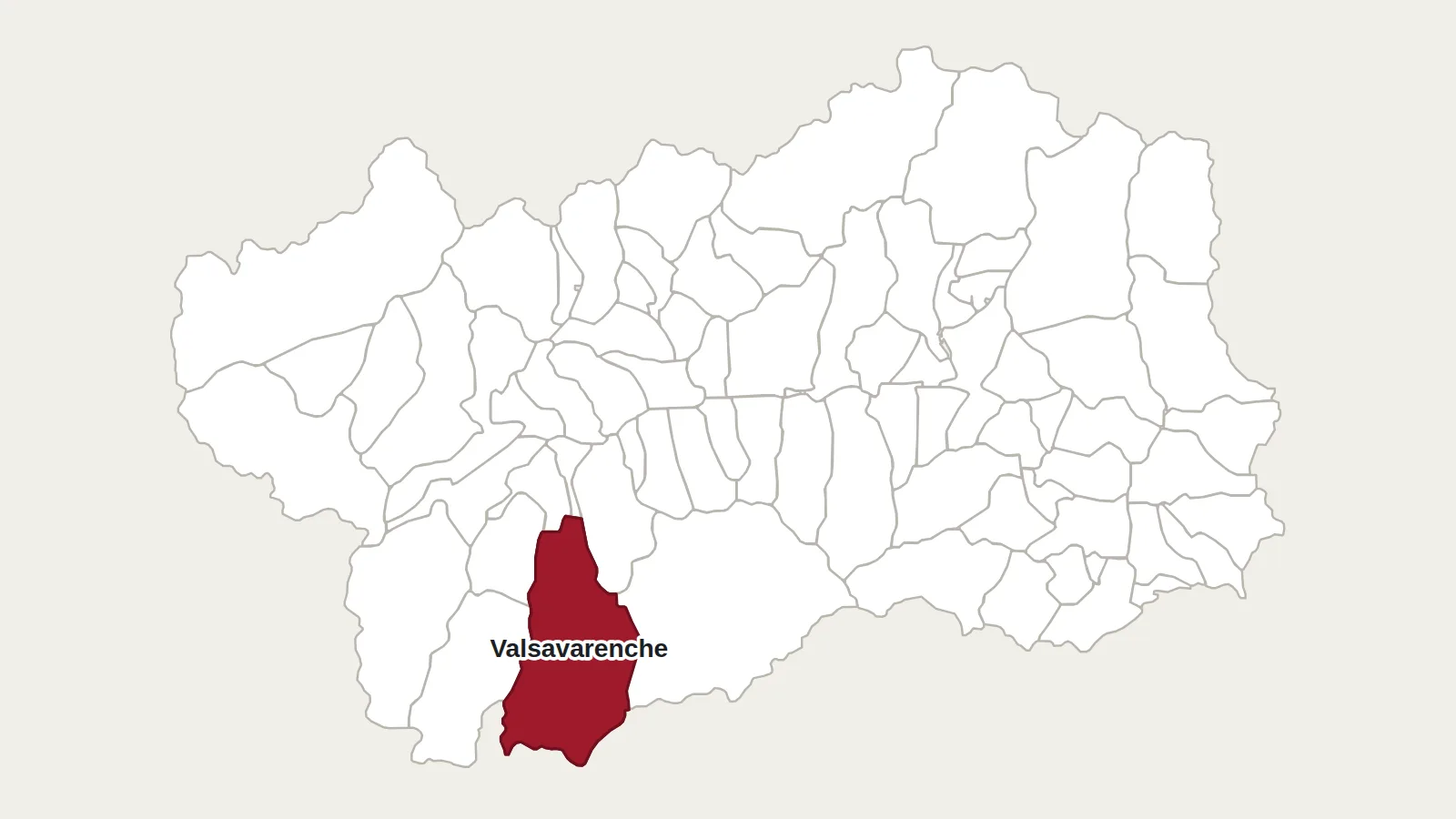
Main photo: Paweł Kuźniar (Jojo_1), CC BY-SA 3.0, via Wikimedia Commons.
Maps: personal work by Marc Badjou.
Comments